
The Audubon's Broadmoor Sanctuary has always been closely tied to 262 Eliot St, from the mid-20th century when Roger Williams maintained the three cascading dams and right up until today. Most of the 800 acres of sanctuary land were donated in the mid-1970s through the will of a physician named Stillman (no relation to us).
The first director, Bruce Lund, built almost all of the nine miles of trails and also the oldest part of the boardwalk. Current director Elissa Landry called in the Army Corps of Engineers in the 80s. They surveyed the wetlands and obtained involuntary conservation easements from the Eliot St abutters.
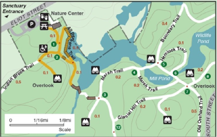 Broadmoor official map (not to scale) showing the wetlands behind 262 Eliot St that were donated, making that lot smaller than the neighbors' lots.Instead of granting an easement, we donated a little more than an acre of wetlands to the Audubon Society, and that is why this lot is so much shorter than others alongside it. The remaining 1.75 acres is all high and dry except for a narrow strip at the water's edge. You could not make a donation like that today because the Town of Natick would never permit acreage to be removed from the tax rolls. Having only 1.75 acres, rather than three acres, is part of why the taxes are so low relative to other houses nearby.
Much of the early history of the sanctuary is probably documented online, but here are some facts that might not be. The first dam and a grist mill were built by Tom Sawin for the Natick Indians, who paid him with a home site nearby where his 17th century house still stands. (The barn, behind the Sawin house, was built in the 1990s while I was on the sanctuary Board of Trustees and I helped fund its construction.) The Indians, who were "converted" (ie, enslaved) by preacher John Eliot, who also built the South Natick church in the 1600s and founded the Roxbury Latin School, had always spent their summers up on the Cohituate Lakes and wintered on Cape Cod, using Indian Brook to travel from the lakes to the Charles River.
Below the grist mill and above the biggest of the three dams was once a post-and-beam lumber mill that stood four stories high. It burned down around the turn of the 19th century. What was back in those horse-and-buggy days the main road is today a broad footpath that passes the mill sites.
All the land was cleared for pasture and farming in colonial times and not a single specimen of old growth trees remains for miles around. Most of the pine trees near the Sanctuary boardwalk were planted, all at once, shortly after WW II. They are all about the same age and can be seen to grow in rows.
Perhaps the oldest tree around is an oak at the SW corner of the 262 Eliot St lot, using the current lot lines. It is not much to look at, however, because it was struck by lightning in the 1960s. Notice evidence of beaver close nearby.
The Broadmoor trails were open to horse riding until around Y2K. There is an equestrian entrance, alongside the 19th century farmhouse at 250 Eliot St, that is blocked off now but not posted. You can enter the sanctuary here at any time, even when it is closed, and then exit at the visitor center, but watch out for poison ivy near the road at both ends.
The visitor center's solar powered barn, a marvel of green architecture, was a livery stable in the early 1900s. After the rise of automobiles, it became a chicken farm. The Middlemas family raised corn to feed their chickens on the land all along Eliot St, including 262. They fed up to 3,000 chickens at a time and could do this without irrigation only about two years in three.
Up until WW II, South Natick was a separate town called Morseville. It lost so much population during the war that it merged into Natick, although it is still a distinctively different community. The library in South Natick has a small museum in its basement and would be a good place to look for more historical info. Google "Morseville, MA" and note what location appears.